Uluru Facts, History, Formation, and Aboriginal Significance
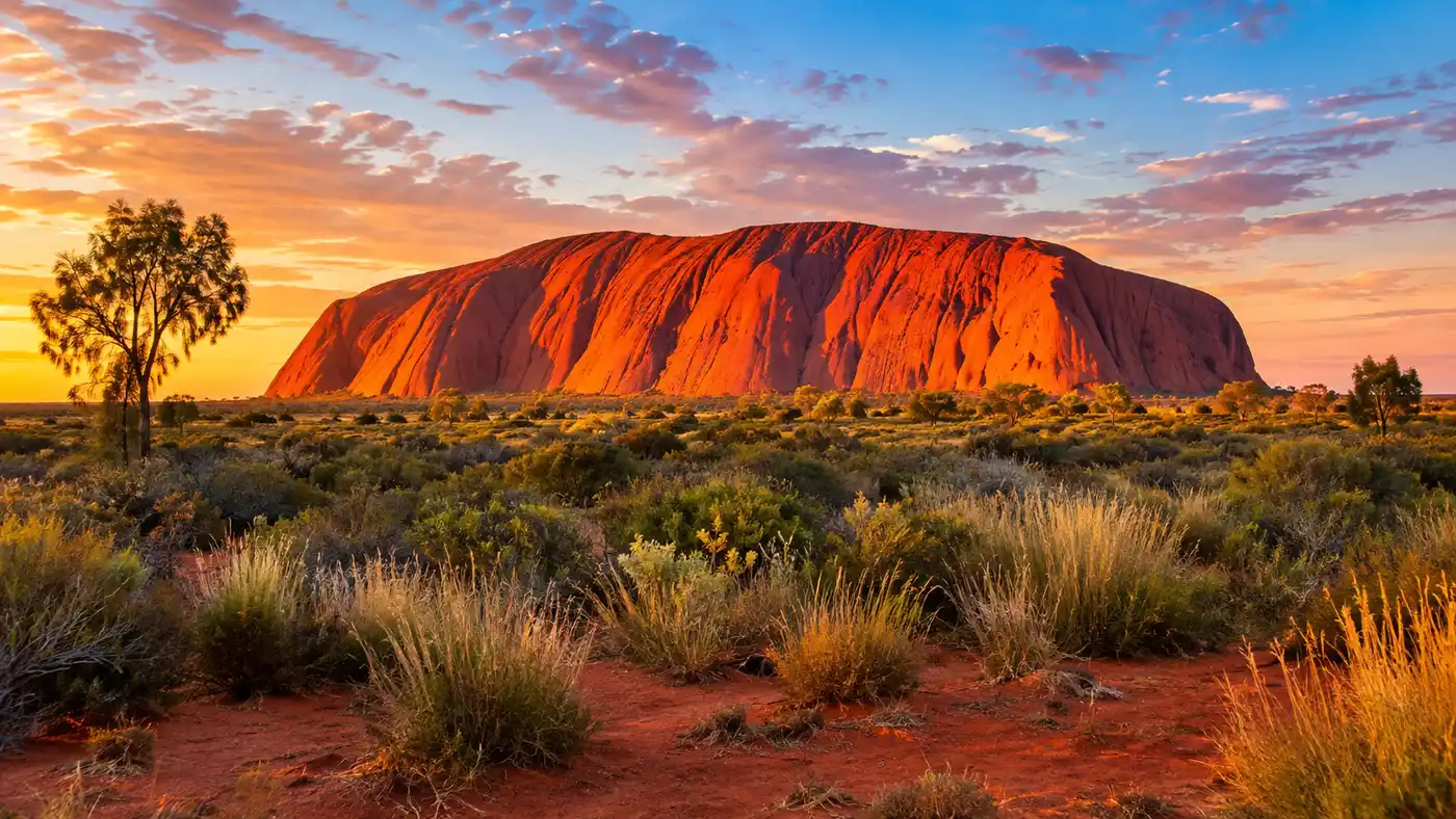
Standing in the red dust of the Red Centre while the sun dips down will reframe how you look at deserts. Most visitors arrive expecting a simple desert boulder, but digging into actual uluru facts quickly reveals something far stranger, older, and culturally richer than a postcard photo. This giant sandstone monolith dominates the flat desert plain around it, pulling in about 250,000 visitors every year from all over the planet.
Whether you know it as Ayers Rock or its traditional name Uluṟu, this place holds profound spiritual weight for Australia's First Nations people. We will break down how it formed hundreds of millions of years ago, why it changes from fiery ochre to deep purple at sunset, how the local Anangu people live alongside it, and the essential details you should know before visiting central Australia.
Book your australia uluru tour experience:
Essential Uluru Facts: Size, Height, and Numbers
People always ask if Uluru is the biggest rock on earth. It actually is not. That title belongs to Mount Augustus in Western Australia, which is an inselberg about twice the size. Still, Uluru is enormous. It rises 348 meters above the surrounding sand plain, making it taller than the Eiffel Tower by 18 meters, and sits 863 meters above sea level.
Walking around the base takes roughly 3 to 4 hours along a 10.6 kilometer trail. If you looked down from an aircraft, you would see an oval shape measuring 3.6 kilometers long by 2.4 kilometers wide. What blows most people away is what sits underground. The rock behaves like an iceberg in the desert, extending anywhere between 2.5 and 6 kilometers straight down into the earth's crust.
Note: Climbing the rock has been permanently prohibited since October 26, 2019, honoring the explicit cultural wishes of the Anangu traditional owners and ending decades of safety and environmental damage.
To put its sheer scale and desert conditions into perspective, here is how its basic physical measurements stack up:
| Feature | Measurement | Comparison / Detail |
|---|---|---|
| Height above ground | 348 meters (1,142 ft) | Taller than the Eiffel Tower (330 m) |
| Circumference at base | 9.4 kilometers (5.8 mi) | Roughly 10.6 km via the Base Walk track |
| Total length | 3.6 kilometers (2.2 mi) | Aligned roughly northwest to southeast |
| Underground depth | 2.5 to 6 kilometers | Part of a massive subterranean sandstone layer |
| Distance from Alice Springs | 468 kilometers (290 mi) | About 4.5 hours by car along sealed highway |
Geological Formation: How Was Uluru Created?
The geological story started around 550 million years ago during the Petermann Orogeny. Tectonic forces crumpled central Australia, shoving up massive mountain ranges that may have rivaled the modern Himalayas. Torrential rains stripped these ancient peaks down, washing vast fans of coarse gravel, feldspar, and quartz sand down into a shallow inland sea known as the Amadeus Basin.
Over tens of millions of years, the weight of accumulating sediments crushed those sand deposits into arkose sandstone. Around 400 million years ago, another massive regional upheaval - the Alice Springs Orogeny - folded and tipped the entire sandstone layer nearly vertical, tilting it at roughly 85 degrees. The softer surrounding rocks slowly washed away over endless dry eons, leaving the hard sandstone slab sticking out of the desert plain. It is technically an inselberg, an 'island mountain'.
Why is Uluru red? The fresh rock inside is actually grey. Centuries of desert rain and dry heat oxidized the iron minerals locked in the arkosic sandstone, forming a thin crust of rust across the entire outer skin. As sunlight shifts throughout the day, the iron grains scatter light differently, producing those dramatic shades of orange, rust red, and dusk purple. If you want to plan your days around the best light and cooler weather, reading up on the best time to visit Uluru helps avoid the midday heatwaves.
Anangu Culture, Tjukurpa, and Spiritual Significance
Geology tells half the story; for the Anangu people - who have lived in the region for at least 30,000 years - Uluru is a living cultural landscape shaped by ancient creation ancestors. In Anangu culture, this fundamental law and spiritual belief system is called Tjukurpa (pronounced 'chook-orr-pa'). It explains how people, animals, plants, and landforms came into existence and dictates how life should be lived today.
Look closely at the rock walls and you will see shapes that geologists call cavernous weathering pits, but to traditional owners, they are marks left by ancestral beings. The deep parallel fissures on the southern face show where Kuniya, the Python Woman, struck the poisonous Liru snake warrior in retribution for killing her nephew. Cave hollows mark ancestral campsites. Pockmarks near waterholes show where ancient beings threw spears during epic battles.
Pro tip: Drop into the Uluṟu-Kata Tjuṯa Cultural Centre before heading out to the rock faces, because understanding the creation stories makes the stone shapes suddenly come alive.
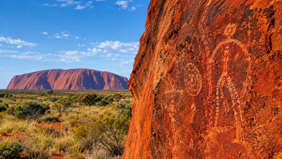
Aboriginal rock art shelters dot the base caves, layered with generations of red ochre, white kaolin clay, and charcoal drawings. These were not just decorations. Anangu elders used these paintings like chalkboards to teach younger generations where to find bush food, how to track emus, and how to navigate desert survival. Many caves along the perimeter remain deeply sacred, reserved exclusively for men's or women's business, which is why commercial photography of specific sections is restricted.
Book your australia uluru tour experience:
European Discovery, Name Changes, and Joint Management
Surveyor William Gosse became the first European to lay eyes on the formation in July 1873, christening it Ayers Rock in honor of the Chief Secretary of South Australia, Sir Henry Ayers. Gosse had spotted it from afar while cutting tracks through sandhills, marveling at the sheer incongruity of a crimson wall jutting out of flat spinifex plains. Decades of pastoral expansion, mineral prospecting, and rough outback tourism followed, often pushing local Aboriginal families out of their ancestral lands.
Things shifted dramatically on October 26, 1985. In a historic ceremony, the Australian Government handed title deeds back to the Anangu traditional owners, who immediately leased the land back to the Australian Parks service under a joint management agreement. In 1993, the dual name 'Ayers Rock / Uluru' was officially established, eventually flipped to 'Uluru / Ayers Rock' in 2002 to prioritize the original indigenous name.
Planning a route out here takes some thought given the remote distances. Drivers usually arrive along the Lasseter Highway, and exploring the logistics in a guide on how to get to Uluru will save you from common desert road trip mistakes. The township of Yulara, sitting roughly 20 kilometers outside the national park gate, holds all the resort lodging, petrol stations, and supply stores.
Wildlife and Desert Survival Around the Monolith
City folks often assume central Australia is a barren, dead wasteland, but Uluru functions as a massive desert sponge. When the rare rains fall, water sheets off the steep slickrock, funnels into narrow grooves, and thunders into base plunge pools like Mutitjulu Waterhole. These shaded rock pools retain moisture long after rain clouds clear, creating micro-oases where life thrives.
Here are several distinct plant and animal species that manage to thrive around the base of the rock:
- Thorny Devils: small spiky lizards that consume thousands of black ants a day using specialized capillary grooves along their skin to draw morning dew straight to their mouths.
- Black-footed Rock-wallabies: nimble marsupials that hide among shaded boulder crevices during baking afternoons and emerge along cliff edges at dusk.
- Wandering Dingoes: apex desert predators whose tracks run along red sandy creek beds throughout the park.
- Mulga Trees and Spinifex: hardy acacia shrubs and spiked needle grass that lock down shifting desert dunes and anchor the surrounding sand plain.
The summer months bring millions of bush flies and afternoon temperatures north of 40 degrees Celsius. I always tell friends to buy a cheap mesh head net at the Yulara resort shop; it looks ridiculous in selfies, but it prevents sheer misery when flies decide to seek moisture from your eyes and mouth along the trail.
Frequently Asked Questions about uluru facts
Why was the Uluru climb permanently closed?
The climb closed in October 2019 out of respect for Anangu culture, which considers the summit track a sacred path walked by creation ancestors. Long-standing safety risks, medical emergencies, and rubbish pollution on the summit contributed to the decision made by the joint management board.
What rock type is Uluru made of?
Uluru is made of arkose, a coarse-grained sandstone rich in feldspar mineral grains and quartz sand. The rock mass was deposited over 500 million years ago and tilted nearly vertical during prehistoric tectonic movements.
How do you pronounce Uluru correctly?
The correct pronunciation used by Anangu is 'Oo-loo-roo', with equal, light emphasis on all three syllables and a gentle rolling 'r'. It should not be spoken with a hard English accent.
Quick Reference
- Height: 348 meters above ground level
- Age: Sediment deposited roughly 550 million years ago
- Rock type: Feldspar-rich arkose sandstone
- Park entry fee: $38 per adult for a 3-day pass
- Climb status: Permanently closed since October 2019
Book your australia uluru tour experience:
Before You Go
Seeing photographs of this sandstone titan will never prepare you for standing at its base, running your fingers along cool red crevices while listening to the wind sweep through desert oaks. Spend at least three full days out here to watch the sun rise and fall from opposite sides of the park, and give yourself time to sit quietly near Mutitjulu Waterhole. It is a sacred place with an immense heartbeat, well worth the long trek deep into Australia's red heart.
Read more about australia uluru tour.